Coastal Geology & Geophysics
For more than 30 years, APTIM has provided professional coastal and marine, geological, and geophysical surveys, as well as scientific services to clients. We have earned an excellent reputation with federal, state, and local agencies responsible for permitting and overseeing coastal and marine programs.
An Industry-leading Coastal Geology Partner
We specialize in identifying high-quality beach and marsh restoration-compatible fill resources. Our team members are experts in the use of remote sensing techniques, marine geophysical data collection, processing, interpretation, and combining geomorphological mapping with geotechnical measurements to locate and define sediment deposits accurately and effectively.
The data we collect is used to determine the presence of specific geomorphic features such as large, incised valleys, sand flats, submerged shoals, and channel complexes known to produce large quantities of sand or mixed sediment.
This data is also used to identify potential cultural resources such as artifacts, underwater wrecks, submerged hazards, significant relict landforms, or any other features, including modern debris that may impact borrow area delineation and dredging activities. Learn more about Cultural Resources Management.
Using geologic models and state-of-the-art geophysical and geotechnical equipment, we have:
- Located more than 500+ million cubic yards of sand to restore America’s beaches
- Designed hundreds of borrow areas that have supported more than 100+ beach nourishment projects throughout Florida, the Gulf Coast, and the Atlantic Seaboard
- Conducted thousands of miles of offshore geophysical surveys to provide effective and efficient services for offshore energy and infrastructure projects
APTIM is fortunate to have worked on several statewide geotechnical and geophysical databases for Louisiana, Florida, and Texas. Our regional sediment search approach is so successful that it has been incorporated into Louisiana’s Office of Coastal Protection and Restoration Authority (CPRA) “General Guidelines: Exploration for Offshore Sand Sources” and the Florida Department of Environmental Protection’s “Offshore Sand Search Guidelines.”.
Our work is supported by our sediment geotechnical laboratory, which is accredited by CMEC, Inc. for American Society for Testing and Materials (ASTM) D1140 (analysis of sediment finer than the No. 200 sieve (3.75phi), D422/T88 Sieve Analysis, D6913 (particle size analysis of soils), D4648 (miniature vane shear test for saturated fine grained clayey soil), and CPE-HAT-09 (carbonate content determination). Our lab is also USACE certified.
In addition to our scientific expertise, we are innovating a technological approach to offshore sediment management with the recent development of the Louisiana Sediment Availability and Allocation Program (LASAAP) for CPRA, as well as currently teaming with The Water Institute to develop the Northern Gulf Sediment Availability and Allocation Program. These geospatial toolboxes will further enhance coastal managers understanding of sediment needs, availability, and resource use conflicts.
APTIM’s Coastal Team
Our team of geologists, geophysicists, marine archaeologists, and marine scientists are ready to help protect and restore your communities’ coastlines with proven results and the following capabilities:
- Baseline Environmental Surveys
- Borrow Area Design and Permitting
- Cultural Resources Management (CRM)
- Database Management
- Environmental Habitat Mapping and Clearance
- Geohazard and Resource Mapping
- Geotechnical Data Collection and Analysis
- Infrastructure Planning and Clearance
- Marine Geophysical Data Collection, Processing, and Interpretation
- Marine Sediment Resource Identification
- Offshore Infrastructure Decommissioning
- Underwater Archaeology
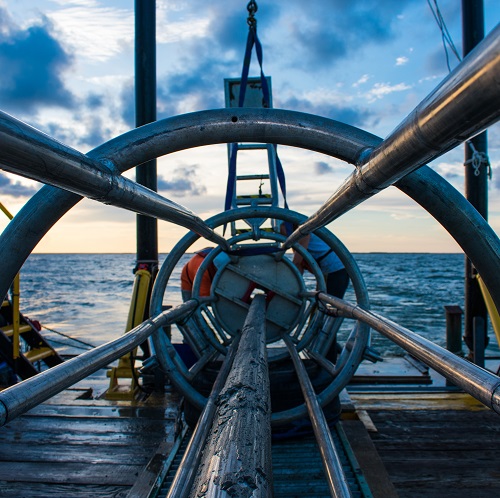
State-of-the-art Equipment and Success
APTIM’s full array of equipment and software enable us to accomplish a wide range of project tasks and allow for the development of multiple strategies for overcoming obstacles in a variety of marine environments.
- Multibeam Sonars/Single Beam Fathometers
- Magnetometers and Gradiometers
- Sidescan and Interferometric Sonars
- Sub-bottom Profilers
- Electric Vibracore System
- USACE and CMEC Accredited Laboratory
Looking for Coastal Management Services? Think APTIM.
The following submarket disciplines make up the remainder of our comprehensive coastal sciences and engineering offerings:
APTIM. In Pursuit of Better.