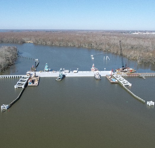
Bayou Teche Flood Control Structure
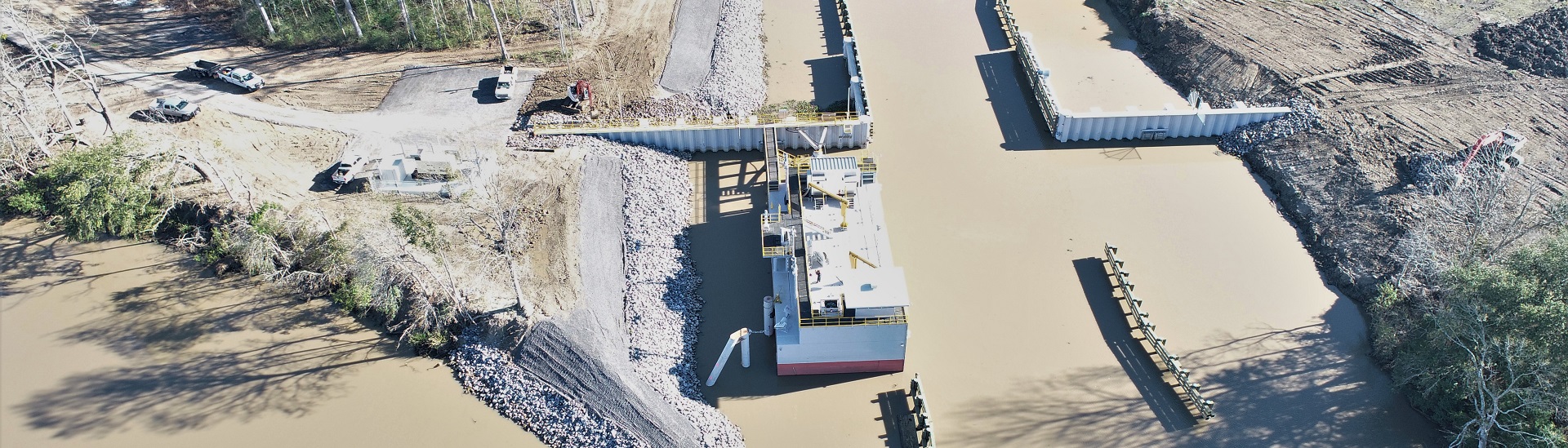
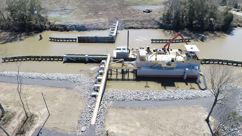
APTIM's coastal sciences and flood control teams provided design and engineering expertise to St. Mary Levee District as they worked to construct a flood protection structure in Bayou Teche, creating a closed system that will reduce the risk of storm surge entering into Bayou Teche via the Charenton Canal.
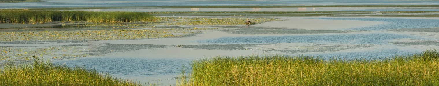
A History of Vulnerability to Rising Water Levels
Over the past 20 years, coastal Louisiana has continuously lost protection provided by barrier islands and wetlands. Hurricanes Rita, Katrina, Gustav, Ike, and Isaac have had a marked impact on this reduction. As such, St. Mary Parish has become increasingly susceptible to flood events, with flooding identified as a major concern in the 2014 St. Mary Parish Hazard Mitigation Plan.
Recently completed flood control projects such as the Franklin Canal Flood Control Structure, the Hanson Canal Flood Control Structure, and the Yellow Bayou Flood Control Structure are critical components of a comprehensive flood protection system that reduce the parish’s flood risk. Susceptibility to flooding for the city of Franklin, LA as well as unincorporated areas north of Franklin is the largest remaining challenge for this overall flood protection system.
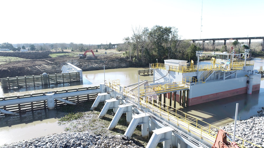
The construction of the Bayou Teche Flood Control Structure (BTFCS) in Bayou Teche will fill the current gap, creating a closed flood protection system to protect the city of Franklin and neighboring unincorporated areas from flooding. The BTFCS project will also create an area of protection to an EL 10.0’ between the proposed gate location and the Wax Lake Outlet. This area of protection includes approximately 6,500 properties with 79% of that total being residential properties with a population of almost 13,500. Almost 22,000 agriculture acres are included in this area of protection as well.
Bayou Teche Flood Control Structure Design and Engineering
The BTFCS project is located in the Vermilion-Teche Watershed in the Atchafalaya Hydrologic Basin. Most of the storm water drainage of the surrounding area to the northeast drains through the Charenton Canal into the Gulf of Mexico. Storm surge also travels north through the Charenton Canal into the Vermilion-Teche Watershed and the Atchafalaya Basin during hurricane and/or tropical events. The BTFCS project will reduce the risk of storm surge entering into Bayou Teche via the Charenton Canal.
The project consists of the following:
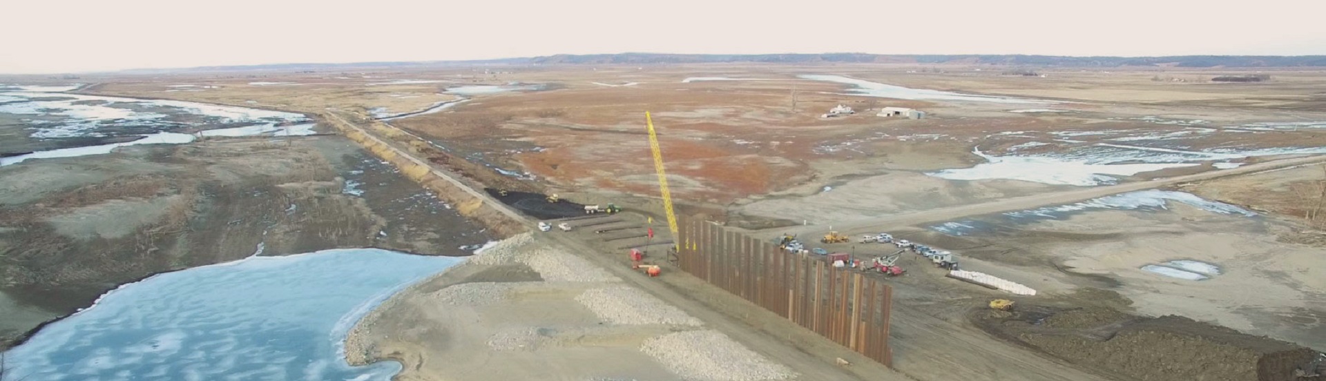
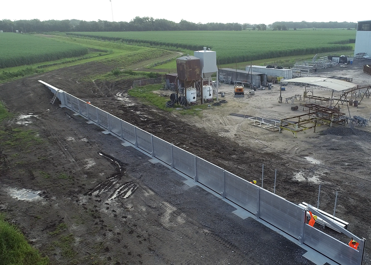
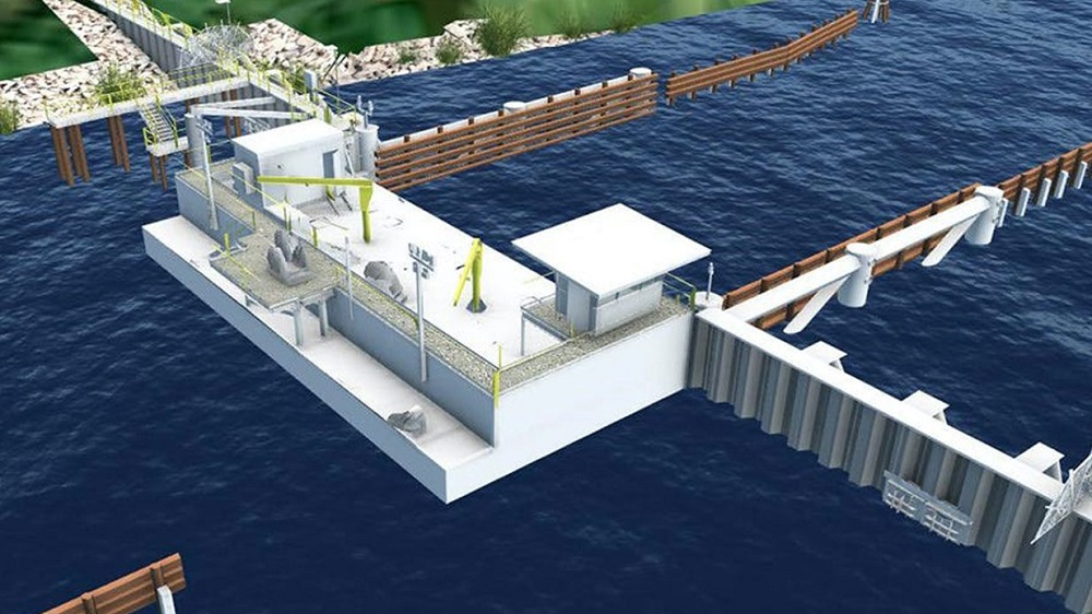
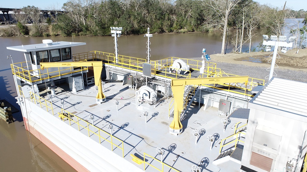
- Construction and installation of a steel floodgate that is approximately 84’ long by 40’ wide by 19’ high with a 7′ high floodwall to EL. 12.0’.
- Construction of steel receiving structure (to EL. 12.0’) consisting of braced steel frame (jacket) on vertical pipe piles, cutoff walls and landing piles to support the gate in the closed position. Clear opening of 75’ to be provided.
- Installation of braced steel sheet pile floodwalls (to EL. 12.0’) with a waler and braced by vertical and battered piles
- Installation of mooring pile and protection dolphins
- Installation of pivot and pull structures for opening and closing the floodgate
- Construction and installation of a levee (to EL. 10.0’) which extends from HWY 87 to the floodgate with a turnaround and generator pad at the floodgate structure
- Dredging and scour protection
With the Bayou Teche Flood Control Structure project in place and operational, the interior storage area would have enough retention capacity for a 25-year rain event, while also providing flood risk reduction for a 10′ storm surge. To further combat rainfall events in the basin, flow-through pipes would be provided in the floodwall allowing rainwater to escape when the water elevation outside the gate is lower than the water elevation inside the gate.
APTIM’s Waterways and Flood Control Expertise
Our team of flood protection design and engineering specialists offer a comprehensive range of flood control, hurricane protection, coastal engineering, science and technology, as well as port and marine-related services. With approximately 250 employees worldwide, the team ranks among the largest science and engineering groups dedicated to supporting clients in the coastal, marine, mining, and energy industries. We are able to offer:
- Earthen Levee; Civil Flood Protection Design
- Ecosystem Restoration / Flood Control
- Engineering During Construction
- Flood Protection Structure Program
- Floodplain Management
- Flood Fighting
- Impact Assessments, NEPA, and Permitting
- Laser Scan and Drones
- Monitoring and Compliance
- Owners Representative
- Planning, Design, and Feasibility Studies
- Project Permits; Regulatory Process
- Topographic and Hydrographic Surveys

APTIM. In Pursuit of Better.
Submit a Request
To learn more about our design and engineering capabilities for waterways and flood control.
Subscribe to the APTIM Xchange Newsletter
APTIM's newsletter, The APTIM Xchange, provides industry news flashes, regulatory updates, service spotlights, and topical columns from our subject matter experts.